A Park offering playground equipment and a shelter. Basketball and tennis courts are open for public use. A Community Service Project will take place at the park on Saturday. Open Dawn to Dusk.
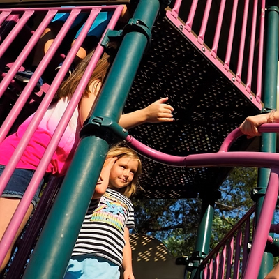
A Park offering playground equipment and a shelter. Basketball and tennis courts are open for public use. A Community Service Project will take place at the park on Saturday. Open Dawn to Dusk.
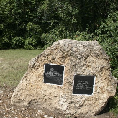
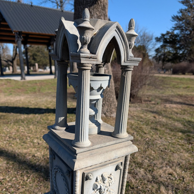
Twelve limestone markers placed throughout the town feature etched marble plaques that provide a pictorial history of the 1861 Humboldt raid and burning by Confederate forces.
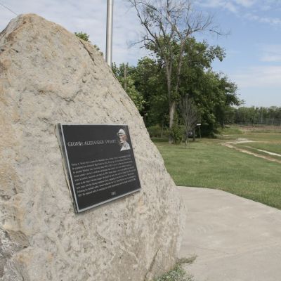
A native of Humboldt, George Sweatt was second baseman from 1922 to 1927 for the Kansas City Monarchs and the Chicago American Giants in the Negro National League. The Monarchs won the first World Series with the Washington Senators. In the mid-1970s this park was named in honor of Sweatt, and a plaque about him and his career is mounted on a large boulder just beyond left field.
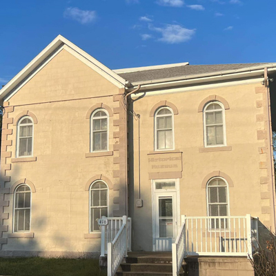
Housed in the historic 1876 residence of a former wealthy merchant, the museum is where to start your exploration of town history, which includes the Monarch Cement plant and baseball greats Walter Johnson and George Sweatt. Free water and cookies availalble to BKRT guests.
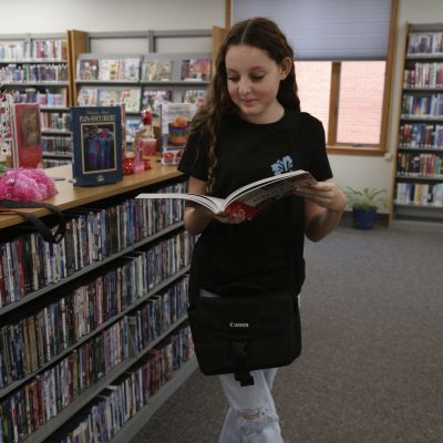
Visit the Humboldt Public Library! There are around 50 different magazine subscriptions to choose from as well as local newspapers. In addition to their collection, they are a great location for a rest or to use the restrooms.
In September 1861 Confederate forces raided Humboldt and returned in October to burn the town. A Civil War monument on the northwest side of the square includes a mural of marble etchings portraying this traumatic time in Humboldt history. A 1907 bandstand and a veterans memorial also grace the square.
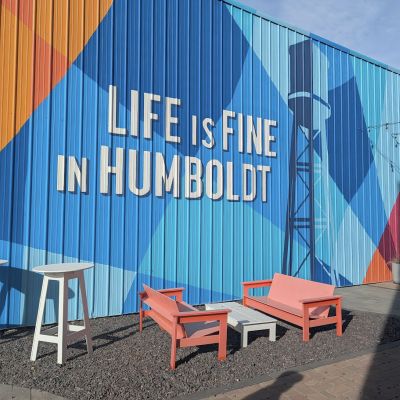
You can enjoy one little slice of the fine life at the Life is Fine pocket park plaza complete with outdoor seating and Humboldt’s iconic “Life is Fine” mural. Open dawn to dusk.
Established in 1940, the cemetery spreads over 40 acres of ground, with an ? mile drive entrance off Hawaii Rd. with nearly 6,000 graves listed on Find a Grave, this picturesque cemetery offers a green space for quiet contemplation and walking.
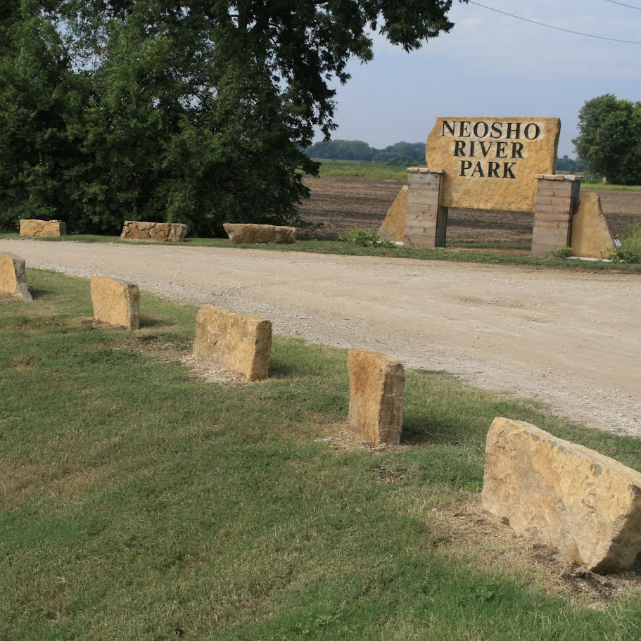
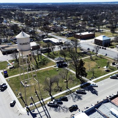
Overlooking the Neosho River dam is a beautiful amphitheater made from large native limestone blocks. In season, flowers bloom in the Osage Prayer Wheel. Enjoy the picturesque setting. An open staircase takes you down for a closer look at the river.
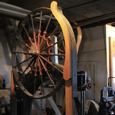
Patrick Haire has one of the most unique working setups in the state, He crafts period-style furniture using a system of pulleys and wheels to power the antique machines. Step into another era when you’re among the sawdust, belts, and old-time tools. Open Friday and Saturday, 8am-5pm.
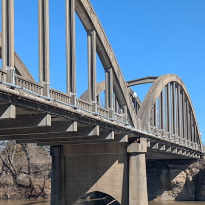
A rare 1932 Marsh rainbow double-arch bridge spanning the Neosho River provides a beautiful entrance to Humboldt from the west. Open to visit at any time.
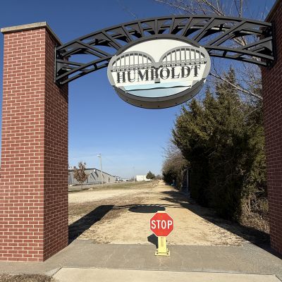
From this trailhead, all roads lead north along a former Santa Fe rail line. Follow it 6½ miles to Iola’s Riverside Park then, if you wish, continue 51 more miles on the Prairie Spirit Trail to Ottawa. The crushed-stone surface on this scenic route is accessible for wheelchairs, bicycles, and walking.
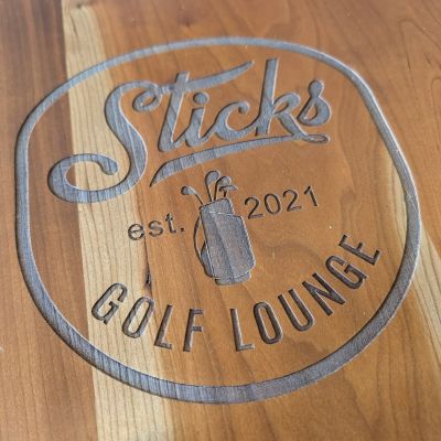
With over 100K virtual courses to play, this 3-bay virtual golf space also includes a Vintage Golden Tee, a Dart Board, and a Full Bar. Saturday special for BKRT guests of 10% off Virtual Golf all day, and live music from 1-3pm. Open Friday 4pm-11pm and extended hours on Saturday from noon-11pm.
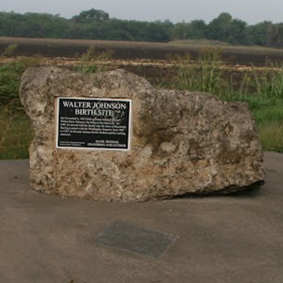
A Humboldt native, Johnson was one of the premiere baseball pitchers when he played for the Washington Senators from 1907 to 1927. He was nicknamed “The Big Train” due to the power and speed of his fastball. The site of Johnson’s birthplace is in a corner of a field near Iola and 900 Rd where a plaque on a large native stone marks his birth site. In front of the stone, a home plate and pitching mound are embedded in a concrete base. Learn more about Johnson's life at the Humboldt Historical Museum.
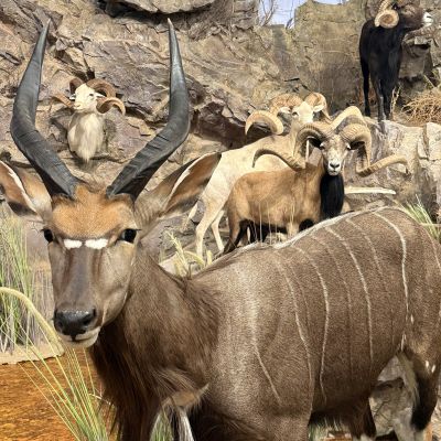
Where Kansas heritage, conservation, and global wildlife come together. Tucked away in the heart of Humboldt, this museum is a one-of-a-collection celebrating the beauty, diversity, and stories of the natural world. There is a seek and find activity with a sticker available for BKRT visitors.